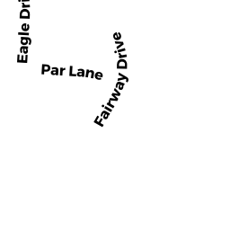
66 PAR LN
Owner Information
RANIERI ROCCO
66 PAR LN
TEWKSBURY, MA 01876


Property Details
66 PAR LN is classified as a Residential Condominium (Condominium - 1%).
The primary structure on this property was built in 1998. There are 1,326ft2 of built area within this property. There is 1,008ft2 of residential/living space within this property.
66 PAR LN is valued at $363,200. The land is valued at $0 and the structures are valued at $363,200.
This property is in Zone MFD. Confirm with local Zoning Board authorities to ensure there are no overlays or other easements on this property.
The most recent deed for 66 PAR LN is recorded at the local registrar in Book 28219, Page 0192. 66 PAR LN was last sold on Wednesday, June 4, 2014 for $265,000.
Assessment data from fiscal year 2021.
Flood Data
This property is partially within the AE Zone (within floodplain). Approximately 26.24 acres (35.09%) of the property is within this zone.
A portion of this property is denoted as being within a floodway.
This information is sourced from the FEMA National Flood Hazard Layer. See our full disclamer.
Broadband Internet Providers
| Provider | Type | Bandwidth (mbps) | |
|---|---|---|---|
| Verizon New England Inc. | Fiber | 940 | 880 |
| HughesNet | Satellite | 25 | 3 |
| VSAT Systems, LLC. | Satellite | 2 | 1 |
| Verizon New England Inc. | DSL | 1 | 0 |
| Viasat Inc | Satellite | 100 | 3 |
| GCI Communication Corp. | Satellite | 0 | 0 |
| Comcast | Cable | 1000 | 35 |
Broadband service provider data from December 2020.
Adjacent Properties
- 14 APACHE WY
Residential Condominium owned by DIVICO CALLIE S - 15 APACHE WY
Residential Condominium owned by CHAMBERS MAUREEN - 16 APACHE WY
Residential Condominium owned by FRATONI MICHAEL A - 17 APACHE WY
Residential Condominium owned by FORTE VINCENT - 18 APACHE WY
Residential Condominium owned by FARINELLA FRANK J - 20 APACHE WY
Residential Condominium owned by ALMEIDA LINDA - 21 APACHE WY
Residential Condominium owned by DILORETO RAYMOND & JOAN - 22 APACHE WY
Residential Condominium owned by DRISCOLL CAROL J - 23 APACHE WY
Residential Condominium owned by WARD JEAN M - 24 APACHE WY
Residential Condominium owned by PESCATORE MICHAEL & VASILAKIS DEANNA - 1-300 APACHE WY
Other, Open Space owned by INDIAN RIDGE CONDO ASSOC - 2 APACHE WY
Residential Condominium owned by JONES JARED R - 3 APACHE WY
Residential Condominium owned by MASCIAVE DORA - 4 APACHE WY
Residential Condominium owned by BROWN GARRETT R - 5 APACHE WY
Residential Condominium owned by DIRUSSO JUDITH A - 6 APACHE WY
Residential Condominium owned by PHELAN MARILYN A - 7 APACHE WY
Residential Condominium owned by THE BRYAN SPELLMAN FAMILY REV TRUST - 8 APACHE WY
Residential Condominium owned by THE ELLIE 2017 TRUST - 10 APACHE WY
Residential Condominium owned by PETROVICH ANTHONY - 11 APACHE WY
Residential Condominium owned by PETERS DEAN M & WILMA F - 12 APACHE WY
Residential Condominium owned by MALONE FRANCIS P - 13 APACHE WY
Residential Condominium owned by MURPHY ANNE L - 26 APACHE WY
Residential Condominium owned by DUCEY ROBERT A - 27 APACHE WY
Residential Condominium owned by HALIKIAS SPIRO & SOFIA - 28 APACHE WY
Residential Condominium owned by MATTSON CLAIRE M - 29 APACHE WY
Residential Condominium owned by BISHNU PARTHA S & SUBHRA - 30 APACHE WY
Residential Condominium owned by BEE JEFFREY D - 31 APACHE WY
Residential Condominium owned by SKINNER ROBERT A - 32 APACHE WY
Residential Condominium owned by WOODS KAREN A - 33 APACHE WY
Residential Condominium owned by COFFILL FRANK W III - 34 APACHE WY
Residential Condominium owned by GAFANHAO SUSAN - 35 APACHE WY
Residential Condominium owned by OSGOOD MARY SULLIVAN - 36 APACHE WY
Residential Condominium owned by FENNELL JANICE M - 37 APACHE WY
Residential Condominium owned by BATTEN J GREGORY - 38 APACHE WY
Residential Condominium owned by GUSTAFSON CHERYL - 39 APACHE WY
Residential Condominium owned by WHITE DENISE M - 40 APACHE WY
Residential Condominium owned by GLADYS M POTHIER LIVING TRUST - 42 APACHE WY
Residential Condominium owned by JOYCE KERRY E - 43 APACHE WY
Residential Condominium owned by PATEL SONAL - 45 APACHE WY
Residential Condominium owned by MAC NEIL CLARE C - 44 APACHE WY
Residential Condominium owned by HEAD JANICE - 46 APACHE WY
Residential Condominium owned by RAYNE MARILYN H - 47 APACHE WY
Residential Condominium owned by GUENETTE EDWARD A - 48 APACHE WY
Residential Condominium owned by CANDELORA JANICE E - 49 APACHE WY
Residential Condominium owned by THE MARY LYTLE WOLFMAN REVOCABLE TRUST - 50 APACHE WY
Residential Condominium owned by ONEILL KENNETH E - 51 APACHE WY
Residential Condominium owned by DEMPSTER JEANNE M - 52 APACHE WY
Residential Condominium owned by WOOD GARY E - 53 APACHE WY
Residential Condominium owned by CULLEN PAULA LEIGH - 54 APACHE WY
Residential Condominium owned by CROWE KATHLEEN M - 55 APACHE WY
Residential Condominium owned by VOLES BENJAMIN F - 57 APACHE WY
Residential Condominium owned by BARILE KEVIN M & MARGARET J - 58 APACHE WY
Residential Condominium owned by SAVOSIK THOMAS JR - 59 APACHE WY
Residential Condominium owned by LIPMAN DERRELL J - 60 APACHE WY
Residential Condominium owned by FUCHS DONNA J - 61 APACHE WY
Residential Condominium owned by OSHEA JOHN J - 62 APACHE WY
Residential Condominium owned by FONG CHARLES J - 63 APACHE WY
Residential Condominium owned by CERTUSI JOYCE A - 124 APACHE WY
Residential Condominium owned by BROWN ELIZABETH A - 125 APACHE WY
Residential Condominium owned by STRAIN PAUL J - 126 APACHE WY
Residential Condominium owned by CURRAN HAROLD V - 127 APACHE WY
Residential Condominium owned by KANE MARY LOU - 128 APACHE WY
Residential Condominium owned by GALLAGHER NANCY R - 129 APACHE WY
Residential Condominium owned by BOUCHER LINDA E - 130 APACHE WY
Residential Condominium owned by GRANT ROBERT F - 131 APACHE WY
Residential Condominium owned by ABBOTT LAUREL A - 133 APACHE WY
Residential Condominium owned by DIMARE DEBORAH A - 134 APACHE WY
Residential Condominium owned by SCHNEIDER WILLIAM J - 135 APACHE WY
Residential Condominium owned by SULLIVAN DONALD P TR - 136 APACHE WY
Residential Condominium owned by CHIN ERICA - 137 APACHE WY
Residential Condominium owned by HARRIS FAMILY TRUST - 138 APACHE WY
Residential Condominium owned by LAPERCHE DEBORAH - 139 APACHE WY
Residential Condominium owned by MAGUIRE DANIEL J & ANNE MARIE - 140 APACHE WY
Residential Condominium owned by SKAHAN DORIS TRACY - 141 APACHE WY
Residential Condominium owned by CURRIER JAMES & - 142 APACHE WY
Residential Condominium owned by KALLURI SURESH - 143 APACHE WY
Residential Condominium owned by ROBERTSON ROBERT S & JANELLE F - 64 APACHE WY
Residential Condominium owned by DWYER CATHY M - 65 APACHE WY
Residential Condominium owned by MANISCALCO GLORIA J - 66 APACHE WY
Residential Condominium owned by HANLON STEPHEN J - 67 APACHE WY
Residential Condominium owned by MEADS JULIE A - 68 APACHE WY
Residential Condominium owned by ADAMS PETER & COX ASHLEY - 69 APACHE WY
Residential Condominium owned by CAROL A DANTONE 2017 LIVING TRUST - 70 APACHE WY
Residential Condominium owned by FRANCIS LAURA T - 71 APACHE WY
Residential Condominium owned by GILLIS SANDRA A - 72 APACHE WY
Residential Condominium owned by MAFFEO JAMES B - 73 APACHE WY
Residential Condominium owned by KELLY AMANDA E - 75 APACHE WY
Residential Condominium owned by LE STEVEN - 76 APACHE WY
Residential Condominium owned by DISTEFANO JOHN A & ANN M - 77 APACHE WY
Residential Condominium owned by MORGANROSE DYNASTY TRUST - 78 APACHE WY
Residential Condominium owned by CABRAL JOHN R & MARIA D - 79 APACHE WY
Residential Condominium owned by HUSE JEANNE M - 80 APACHE WY
Residential Condominium owned by DESAULNIERS AGNES A TR - 81 APACHE WY
Residential Condominium owned by PATEL NIRAVKUMAR & REENA - 82 APACHE WY
Residential Condominium owned by ORTOLANI LISA M - 83 APACHE WY
Residential Condominium owned by BOUDREAU PAUL L & KAREN L - 144 APACHE WY
Residential Condominium owned by MORRIS JAMES - 145 APACHE WY
Residential Condominium owned by RICHARD LIONEL A JR TR - 146 APACHE WY
Residential Condominium owned by PECCI GERTRUDE - 147 APACHE WY
Residential Condominium owned by WU YUENING & HU XIAJUN - 148 APACHE WY
Residential Condominium owned by FAIRWEATHER ROBERT N - 149 APACHE WY
Residential Condominium owned by BRANSON DAVID A - 150 APACHE WY
Residential Condominium owned by JACKSON WARREN TR - 151 APACHE WY
Residential Condominium owned by KAHN MEREDITH JO - 152 APACHE WY
Residential Condominium owned by KLUSE VICTORIA R & JOHN B - 153 APACHE WY
Residential Condominium owned by DAIGLE FAMILY TRUST - 155 APACHE WY
Residential Condominium owned by CAISSE GISELE O - 156 APACHE WY
Residential Condominium owned by LIU JING & SU YING - 157 APACHE WY
Residential Condominium owned by CUMMINGS JAMES - 158 APACHE WY
Residential Condominium owned by LANGONE BARBARA J - 159 APACHE WY
Residential Condominium owned by GATES BETH - 160 APACHE WY
Residential Condominium owned by DUBIE DIANE - 161 APACHE WY
Residential Condominium owned by DORSI LINDA J - 162 APACHE WY
Residential Condominium owned by CASTRO MARIA - 163 APACHE WY
Residential Condominium owned by NORTON KELLY J - 204 APACHE WY
Residential Condominium owned by LUCAS PATRICIA E TR - 205 APACHE WY
Residential Condominium owned by PETROVICH ANTHONY - 206 APACHE WY
Residential Condominium owned by CONLIN JOHN F JR & DOROTHY A - 207 APACHE WY
Residential Condominium owned by PUGLIA JESSICA LEE - 208 APACHE WY
Residential Condominium owned by HOLLAND DONNA M - 210 APACHE WY
Residential Condominium owned by CLEVENGER FRANCES S - 211 APACHE WY
Residential Condominium owned by BRIGGS PATRICIA M - 212 APACHE WY
Residential Condominium owned by TULLOCH CHERINE D - 213 APACHE WY
Residential Condominium owned by MISKOWSKI LYNNE M - 214 APACHE WY
Residential Condominium owned by DEPIERRO DENISE - 215 APACHE WY
Residential Condominium owned by COIRO SAMUEL L JR & CANDEE L - 216 APACHE WY
Residential Condominium owned by MAHONEY JOHN - 217 APACHE WY
Residential Condominium owned by KELLEDY MAUREEN A - 218 APACHE WY
Residential Condominium owned by GALANTE RICHARD M & MARIA E - 219 APACHE WY
Residential Condominium owned by TOMPKINS RENEE MARIE & BURDETT JULIE - 220 APACHE WY
Residential Condominium owned by BERRIGAN STEPHEN - 221 APACHE WY
Residential Condominium owned by AIMS AUDREY E & SCOTT R - 223 APACHE WY
Residential Condominium owned by WAHL JEFFREY M - 85 APACHE WY
Residential Condominium owned by ANZMANN LAWRENCE P & MARY M TR - 86 APACHE WY
Residential Condominium owned by TILLIT LISBETH M - 87 APACHE WY
Residential Condominium owned by ZIRKEL ROBERT J JR - 88 APACHE WY
Residential Condominium owned by ROSS ALAN M - 89 APACHE WY
Residential Condominium owned by MAIER DANIEL - 90 APACHE WY
Residential Condominium owned by SCHAFFNER JEFFREY R - 91 APACHE WY
Residential Condominium owned by TAPPER-BENHAM JOYCE - 92 APACHE WY
Residential Condominium owned by ZACCAGNINI JOHN A - 93 APACHE WY
Residential Condominium owned by GALISE VINCENT & MARIA - 94 APACHE WY
Residential Condominium owned by BROWN MARY - 96 APACHE WY
Residential Condominium owned by REALI JOHN A & PAMELA K - 97 APACHE WY
Residential Condominium owned by CASTRO JOHN J & CAMELLIA T - 98 APACHE WY
Residential Condominium owned by MCMAHON LOIS E - 99 APACHE WY
Residential Condominium owned by MCCLOSKEY BARBARA L - 100 APACHE WY
Residential Condominium owned by LUCAS JOHN - 101 APACHE WY
Residential Condominium owned by TOPPIN GERARD A - 102 APACHE WY
Residential Condominium owned by BLANKENSHIP DOROTHY - 103 APACHE WY
Residential Condominium owned by REID LINDA M - 84 APACHE WY
Residential Condominium owned by PERLBERG MARK L - 164 APACHE WY
Residential Condominium owned by GURNETT KAREN A - 165 APACHE WY
Residential Condominium owned by THOMAS J COSGROVE IRREVOCABLE TRUST - 167 APACHE WY
Residential Condominium owned by PATTI MINJA Y TR - 168 APACHE WY
Residential Condominium owned by MELKONIAN HAKOP JAMES & ELENA - 169 APACHE WY
Residential Condominium owned by PUOPOLO RICHARD A TR - 170 APACHE WY
Residential Condominium owned by MCGOLDRICK ALICIA - 171 APACHE WY
Residential Condominium owned by CASEY KATHLEEN M - 172 APACHE WY
Residential Condominium owned by PREVITE FRANK J & DONNA M TR - 173 APACHE WY
Residential Condominium owned by LAROCCA DEREK J - 174 APACHE WY
Residential Condominium owned by CHURCHILL THOMAS S - 175 APACHE WY
Residential Condominium owned by CHENEY MARY E & MARIE E - 176 APACHE WY
Residential Condominium owned by MOCCIA RICHARD & LIBERTA A - 177 APACHE WY
Residential Condominium owned by DILLS MICHAEL DAVID - 178 APACHE WY
Residential Condominium owned by REARDON MARY B & DIBELLA ASHLEY M - 179 APACHE WY
Residential Condominium owned by ZADER CONSTANCE R - 181 APACHE WY
Residential Condominium owned by NEVILLE STEPHANIE M - 182 APACHE WY
Residential Condominium owned by FEKETE FAMILY REALTY TRUST - 183 APACHE WY
Residential Condominium owned by KLETSOV OLEKSII & KLETSOVA INGA I - 224 APACHE WY
Residential Condominium owned by DYNES COURTNEY - 225 APACHE WY
Residential Condominium owned by LANE JOSEPH A & SARAH C - 226 APACHE WY
Residential Condominium owned by MCDONALD DIANE E - 227 APACHE WY
Residential Condominium owned by IANNACONE GERALD - 228 APACHE WY
Residential Condominium owned by KLEINMAN BARRY S - 230 APACHE WY
Residential Condominium owned by KRITTER JESSICA TERESE - 231 APACHE WY
Residential Condominium owned by AVERY JOHN H & JODY L - 232 APACHE WY
Residential Condominium owned by DESROSIERS DONNA S - 233 APACHE WY
Residential Condominium owned by VENEZIA JOEL - 234 APACHE WY
Residential Condominium owned by DICECCA KAREN A - 235 APACHE WY
Residential Condominium owned by MULHERN JOHN J & MAUREEN C - 236 APACHE WY
Residential Condominium owned by HERRICK ROBERT J - 237 APACHE WY
Residential Condominium owned by MULLIGAN DONALD T & MARY S TR - 238 APACHE WY
Residential Condominium owned by CROGAN LYNNE P - 239 APACHE WY
Residential Condominium owned by POYNTON DIANE D - 240 APACHE WY
Residential Condominium owned by MCGEE DONALD J & ANNE M - 241 APACHE WY
Residential Condominium owned by TURNER ANNA R & WILLIAM A - 243 APACHE WY
Residential Condominium owned by DREW JR DONALD J - 284 APACHE WY
Residential Condominium owned by ERBETTA LUISA GALASSI - 285 APACHE WY
Residential Condominium owned by HUYNH VAN HUY & LI YAZHUO - 286 APACHE WY
Residential Condominium owned by TEJEIRO DONNA M - 287 APACHE WY
Residential Condominium owned by NOTO ANGELO - 288 APACHE WY
Residential Condominium owned by HIGGINS J J & C R TR - 290 APACHE WY
Residential Condominium owned by MISIPH CHERYL - 291 APACHE WY
Residential Condominium owned by FRECHETTE MARGARET M TR - 292 APACHE WY
Residential Condominium owned by YAZEJIAN JACQUELINE J - 293 APACHE WY
Residential Condominium owned by BALLERINI DOMENIC P - 294 APACHE WY
Residential Condominium owned by SECONDINI LINDA - 295 APACHE WY
Residential Condominium owned by HUGHES EMILY OBRIEN - 296 APACHE WY
Residential Condominium owned by MARSHALL VIRGINIA A - 297 APACHE WY
Residential Condominium owned by CLEMENT TRACY S - 298 APACHE WY
Residential Condominium owned by BARBARA OCONNELL REVOCABLE TRUST - 299 APACHE WY
Residential Condominium owned by SLATTERY LAURENCE & JEAN M - 300 APACHE WY
Residential Condominium owned by CARREIRO EVA M - 104 APACHE WY
Residential Condominium owned by MCGLINCHEY MARK - 105 APACHE WY
Residential Condominium owned by DACEY KEVIN MARK - 106 APACHE WY
Residential Condominium owned by HORTH GREGORY P - 107 APACHE WY
Residential Condominium owned by DOHERTY KURT D & LYNNE O - 108 APACHE WY
Residential Condominium owned by CRAWFORD ALLISON - 109 APACHE WY
Residential Condominium owned by HARRING CAROL ANN - 110 APACHE WY
Residential Condominium owned by ZANNI DANA P - 111 APACHE WY
Residential Condominium owned by MEDEIROS LOURDES & VICTOR - 112 APACHE WY
Residential Condominium owned by BRENNAN LAUREN A - 114 APACHE WY
Residential Condominium owned by PROVENCHER DONALD A - 115 APACHE WY
Residential Condominium owned by GEARTY JEAN L - 116 APACHE WY
Residential Condominium owned by AYERS JUDY J - 117 APACHE WY
Residential Condominium owned by HINDS DAVID K - 118 APACHE WY
Residential Condominium owned by FUCHS PAUL F - 119 APACHE WY
Residential Condominium owned by ANDREOTTOLA CHRISTOPHER - 120 APACHE WY
Residential Condominium owned by CLIFFORD ERIC - 121 APACHE WY
Residential Condominium owned by MONTALTO LILA M - 122 APACHE WY
Residential Condominium owned by BOUTIN MICHELLE A - 123 APACHE WY
Residential Condominium owned by SAAD MAZEN - 184 APACHE WY
Residential Condominium owned by ONEILL ROBERT B - 185 APACHE WY
Residential Condominium owned by CORN THOMAS E & KIMBERLY BLAKE - 186 APACHE WY
Residential Condominium owned by SAWATDEE WISAL & HOANG TRUC - 187 APACHE WY
Residential Condominium owned by DICENSO DANIEL A - 188 APACHE WY
Residential Condominium owned by IOSUA CHRISTOPHER J - 189 APACHE WY
Residential Condominium owned by FLAHERTY THOMAS F - 191 APACHE WY
Residential Condominium owned by VALENTE DIANA M - 192 APACHE WY
Residential Condominium owned by DEVLIN JENNIFER B - 193 APACHE WY
Residential Condominium owned by POWER KRISTIN M - 194 APACHE WY
Residential Condominium owned by ONEIL CYNTHIA J - 195 APACHE WY
Residential Condominium owned by ORSULA PETER J - 196 APACHE WY
Residential Condominium owned by FERRIS JOSEPH D - 197 APACHE WY
Residential Condominium owned by BEATRICE ARTHUR J - 198 APACHE WY
Residential Condominium owned by MASTROMARINO CARL F - 199 APACHE WY
Residential Condominium owned by DEGREGORY GAIL J - 200 APACHE WY
Residential Condominium owned by LEE JOAN C - 201 APACHE WY
Residential Condominium owned by SYLVESTER SUSAN E - 202 APACHE WY
Residential Condominium owned by MATSON CARL E & CARL E JR - 244 APACHE WY
Residential Condominium owned by GUARINO CATHERINE - 245 APACHE WY
Residential Condominium owned by OBRIEN MAUREEN A - 246 APACHE WY
Residential Condominium owned by MAZZONE ADAM V & ALAN M - 247 APACHE WY
Residential Condominium owned by DESILETS BRITTANY - 248 APACHE WY
Residential Condominium owned by LANDERS ROBERT G & MARY P - 249 APACHE WY
Residential Condominium owned by CASIELLO MARIA - 251 APACHE WY
Residential Condominium owned by MURPHY EILEEN - 252 APACHE WY
Residential Condominium owned by DELSONNO MARTINA - 253 APACHE WY
Residential Condominium owned by ROTHERMEL TODD A - 254 APACHE WY
Residential Condominium owned by CAGGIANO MICHAEL F - 255 APACHE WY
Residential Condominium owned by KEMPTON MARIANNE P - 256 APACHE WY
Residential Condominium owned by LEE MICHELLE S - 257 APACHE WY
Residential Condominium owned by XHUVELI KRISTJANA - 258 APACHE WY
Residential Condominium owned by COLTON ANNA MARIA & PETER J - 259 APACHE WY
Residential Condominium owned by LAMOUREUX SHEILA A - 260 APACHE WY
Residential Condominium owned by CARUSO CHRISTOPHER & ALESSANDRO - 261 APACHE WY
Residential Condominium owned by WESTON JUDITH H - 262 APACHE WY
Residential Condominium owned by LYONS SARAH E - 263 APACHE WY
Residential Condominium owned by BALDWIN ANNMARIE - 264 APACHE WY
Residential Condominium owned by LAFFEY MEGHAN B - 265 APACHE WY
Residential Condominium owned by LIE ELIAS Y - 266 APACHE WY
Residential Condominium owned by BRAY ROSEMARY P - 267 APACHE WY
Residential Condominium owned by KANNIARD REALTY GROUP INC - 268 APACHE WY
Residential Condominium owned by DRISCOLL MARY E - 269 APACHE WY
Residential Condominium owned by DALLY NERISSA - 271 APACHE WY
Residential Condominium owned by THE MERCEDES TRUST - 272 APACHE WY
Residential Condominium owned by POWER MARK & MAUREEN - 273 APACHE WY
Residential Condominium owned by MULLONEY ROBERT V - 274 APACHE WY
Residential Condominium owned by BAGDIGIAN DAVID H - 275 APACHE WY
Residential Condominium owned by BARABUSH ALAN - 276 APACHE WY
Residential Condominium owned by KARAS VICTOR - 277 APACHE WY
Residential Condominium owned by LAM CHEUNG & CHAN CHONG - 278 APACHE WY
Residential Condominium owned by VOLZ SANDRA C - 279 APACHE WY
Residential Condominium owned by STANLEY FAMILY LIVING TRUST - 280 APACHE WY
Residential Condominium owned by BATTEN J GREGORY - 281 APACHE WY
Residential Condominium owned by MUNRO JILLIAN - 282 APACHE WY
Residential Condominium owned by THE BRUNO FMLY REVOC TRST & BRUNO ASHLEY - 283 APACHE WY
Residential Condominium owned by GWOZDZ MARTHA E - 19 APACHE WY
Residential Condominium owned by MACCARONE MILDRED A TR - 1 APACHE WY
Residential Condominium owned by MOUSHEGIAN EILEEN - 9 APACHE WY
Residential Condominium owned by ZAMBELLO FRANK & DEBORAH - 25 APACHE WY
Residential Condominium owned by JENNINGS LINDA - 41 APACHE WY
Residential Condominium owned by CASTINE NORMA E - 56 APACHE WY
Residential Condominium owned by STRAUB FRANCES C TR - 132 APACHE WY
Residential Condominium owned by BERGLUND KAREN M - 74 APACHE WY
Residential Condominium owned by BAILOT AMY L - 154 APACHE WY
Residential Condominium owned by BASSETT KAREN M - 209 APACHE WY
Residential Condominium owned by SPANO JAMIE M - 222 APACHE WY
Residential Condominium owned by GARABEDIAN DAWNA M - 95 APACHE WY
Residential Condominium owned by BABON EMILY C - 166 APACHE WY
Residential Condominium owned by SHEPARD ROBERT L - 180 APACHE WY
Residential Condominium owned by PUGLIA DEBORAH L - 229 APACHE WY
Residential Condominium owned by MCRAE LOUISE M - 242 APACHE WY
Residential Condominium owned by PATRICIA D MORROW LIVING TRUST - 289 APACHE WY
Residential Condominium owned by HARDY RICKY P - 113 APACHE WY
Residential Condominium owned by MARGOLIS ROBERT J - 190 APACHE WY
Residential Condominium owned by ORTIZ BLANCA T - 203 APACHE WY
Residential Condominium owned by BATTEN J GREGORY - 250 APACHE WY
Residential Condominium owned by DIAS PHYLLIS J - 270 APACHE WY
Residential Condominium owned by ISSA NOOR MOHAMED FAHD & ISSA NADAA F - MITCHELL G DR/OFF
(formerly Municipalities/Districts. Removed June 2009.) owned by TOWN OF TEWKSBURY - 135 LIVINGSTON ST
Single Family Residential owned by 135 LIVINGSTON STREET REALTY TRUST - 125 LIVINGSTON ST
Single Family Residential owned by MATHERS BARBARA A - 115 LIVINGSTON ST
Single Family Residential owned by REARDON MICHAEL - 44 WAYSIDE RD
Single Family Residential owned by DICIOCCIO ANTHONY & LILA C - 21 WAYSIDE RD
Single Family Residential owned by VILLEFRANCHE MATHIEU - 53 WAYSIDE RD
Single Family Residential owned by PINO JOHN J - 54 WAYSIDE RD
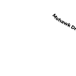
Single Family Residential owned by LAFERRIERE SCOTT & MARYANN - MOHAWK DR
(formerly Municipalities/Districts. Removed June 2009.) owned by TOWN OF TEWKSBURY - 40 BIRCHWOOD RD
Single Family Residential owned by COSTA JOSEPH F & PINHEIRO-COSTA ROSELI R - 50 BIRCHWOOD RD
Single Family Residential owned by BIRCHWOOD REV TRST OF TEWKSBURY MA - 30 BIRCHWOOD RD
Single Family Residential owned by TARENTINO FAMILY IRREVOCABLE TRUST - 20 BIRCHWOOD RD
Single Family Residential owned by CAPADANNO PATRICIA A - 10 BIRCHWOOD RD
Single Family Residential owned by DATTILIO ERIC V & MARCIA E - 1890 MAIN ST/BEHIND
Undevelopable Commercial Land owned by DEMOULAS SUPER MARKETS INC - 1880 MAIN ST
Eating and Drinking Establishments - restaurants, diners, fast food establishments, bars, nightclubs owned by TEWKSBURY COUNTRY CLUB - 85 LIVINGSTON ST
General Office Buildings owned by TEWKSBURY COUNTRY CLUB LLC - 25 HARNDEN WY/ADJACENT
(formerly Municipalities/Districts. Removed June 2009.) owned by TOWN OF TEWKSBURY - 25 HARNDEN WY
Single Family Residential owned by BARBATI ALLESANDRO & JENNIFER - REAR/BIRCHWOOD RD
Golfing - areas of land arranged as a golf course (Ch. 61B, not classified as Open Space) owned by TEWKSBURY COUNTRY CLUB LLC - LIVINGSTON ST
Mass DPHR-Mdl-01 owned by COMMONWEALTH OF MASS